


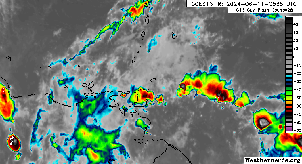
The Trinidad and Tobago Meteorological Service has issued the second Adverse Weather Alert for 2024 as Tropical Wave 07 moves across the area. Heavy rainfall has been ongoing across the country since midnight, with the alert going into effect 6 minutes after issuance by the Met Office.
What you need to know
— Rainfall: Over the next 24 hours, forecast models show additional rainfall accumulations across Trinidad and Tobago has high as 75 millimeters. Generally, eastern areas of Trinidad are forecast to record the highest rainfall accumulations, with isolated high totals across southwestern and northern Trinidad.
— Hazards: The main hazards will originate from heavy showers and thunderstorms, which will produce cloud-to-ground lightning, gusty winds near 55 KM/H), and periods of heavy/violent rainfall, which can trigger street/flash flooding. Seas are forecast to become locally agitated during heavy showers or thunderstorms.
Latest Alerts

TTMS Issues Adverse Weather Alert For T&T
Trinidad and Tobago is NOT under any tropical storm or hurricane threat, watch, or warning at this time.
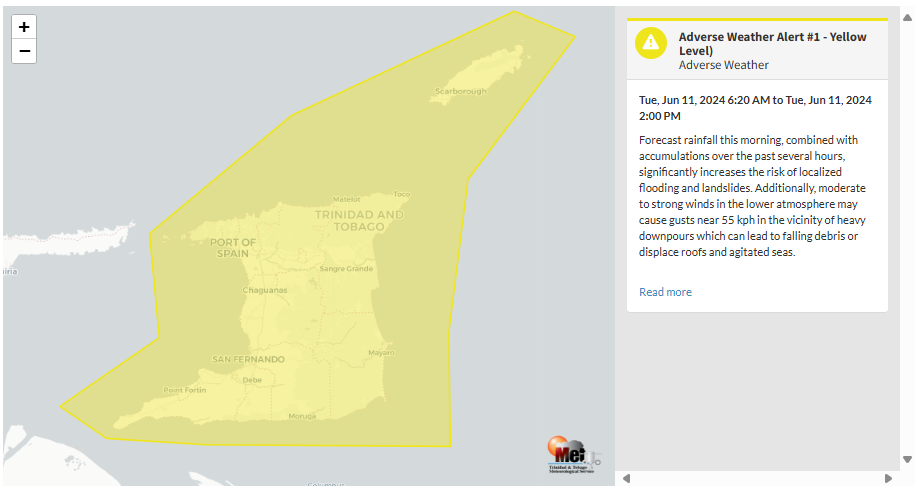
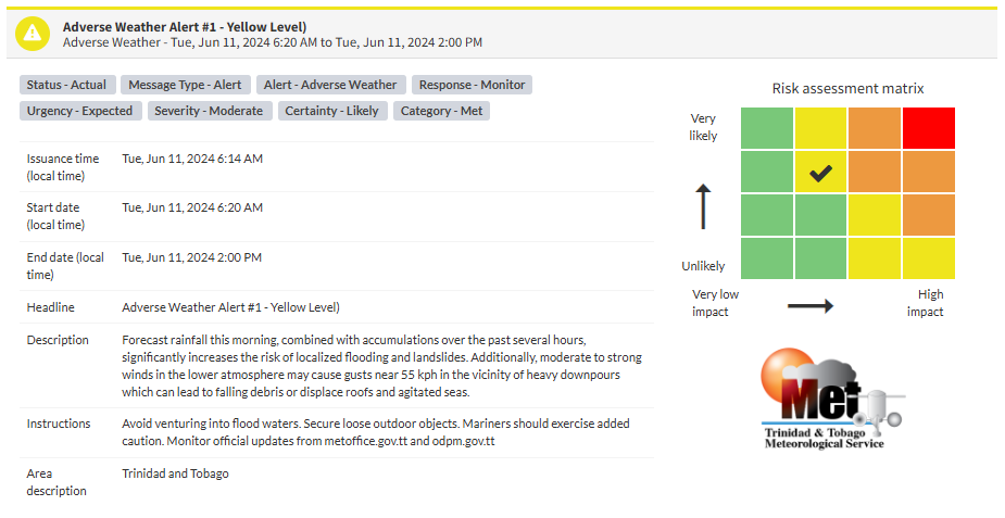
The Adverse Weather Alert
The Trinidad and Tobago Meteorological Service issued an Adverse Weather Alert (Yellow Level) on Tuesday at 6:14 AM. The alert went into effect for Trinidad and Tobago at 6:20 AM Tuesday, June 11th, 2024, and remains in effect until 2:00 PM Tuesday, June 11th, 2024.
As mentioned earlier, the forecast of inclement weather is due to Tropical Wave 07, which has deep-layered moisture, favorable low-level convergence, and favorable upper-level conditions..
This “alert” status considers the possibility of the event occurring. This adverse weather event is likely to have the following impacts, according to the TTMS:
- Forecast rainfall this morning, combined with accumulations over the past several hours, significantly increases the risk of localized flooding and landslides.
- Moderate to strong winds in the lower atmosphere may cause gusts near 55 kph in the vicinity of heavy downpours, which can lead to falling debris or displaced roofs and agitated seas.

The alert’s color indicates the severity of the event and the probability of its occurrence. Currently, the alert level is Yellow. This means that the hazards are likely, and the severity of the impacts is moderate for this particular alert. You should be aware of the hazards in your area associated mainly with gusty winds in excess of 55 KM/H and frequent lightning.
A moderate Adverse Weather Alert can result in possible injuries and behavioral changes are required to ensure safety. Minor damage to property may also occur, temporarily disrupting income-earning activities and affecting a couple of communities.
The Met Office is advising the public not to avoid venturing into flood waters. Secure loose outdoor objects. Mariners should exercise added caution.


