Tropical waves continue to roll off the African Coast. With these early-season tropical waves, showers and thunderstorms tend to be quite spare, and the wind shifts associated with them are quite weak. Over the next week, three tropical waves are forecast to move across the region, but no major rainfall is expected.
What you need to know
— Tropical Wave 01: The axis of this tropical wave is well-defined, located along 84W on Wednesday evening, moving west at 10-15 knots (18-27 KM/H). It moved across T&T last weekend, triggering the start of the 2024 Wet Season, and produced wind damage across Tobago.
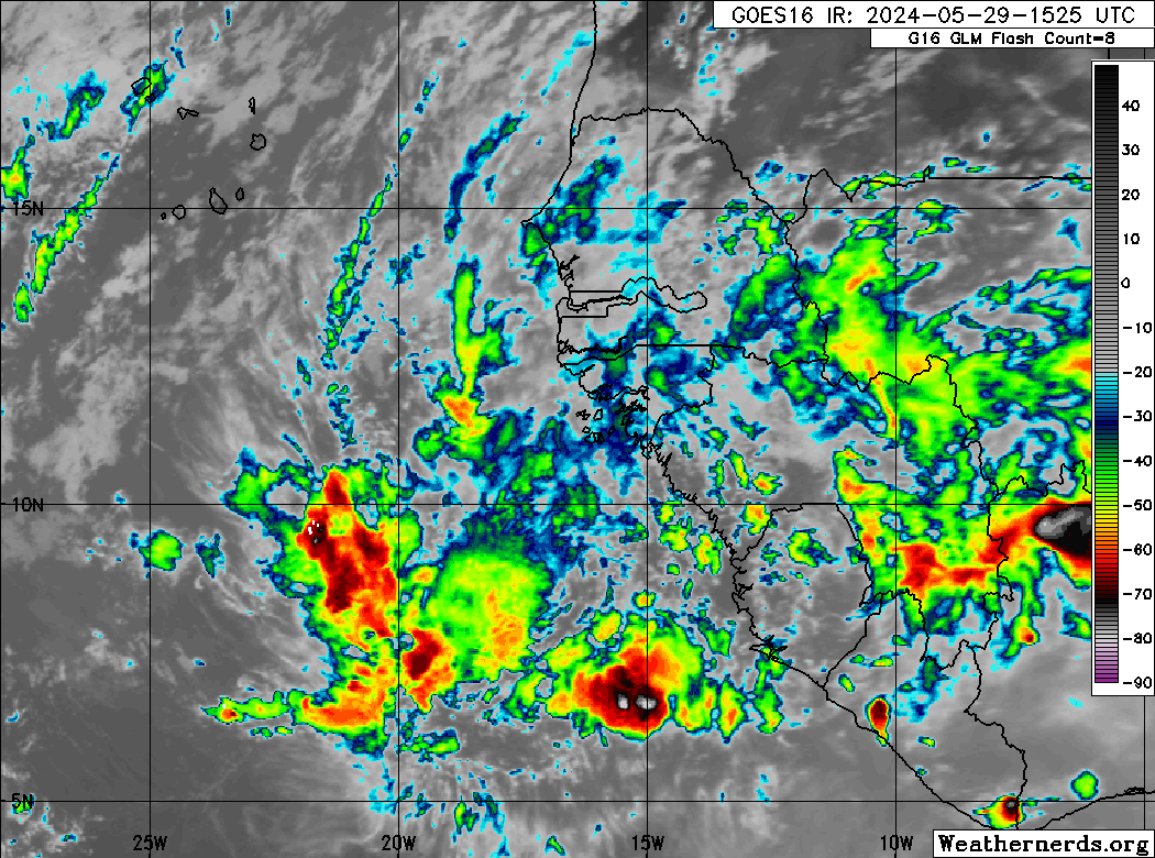
— Tropical Wave 02: The axis of this tropical wave is well-defined, located along 58W and 61W on Wednesday evening, moving west at 15-20 knots (27-37 KM/H). It is forecast to move across Trinidad and Tobago tonight through tomorrow. Rainfall is already ongoing, and is forecast through Thursday afternoon.
— Tropical Wave 03: The axis of this tropical wave is located along 35W on Wednesday evening, moving west at 15-20 knots (27-37 KM/H). Due to a developing low-pressure system in the far North Atlantic, this tropical wave may lose its signature as it nears the Lesser Antilles on Sunday.
— Tropical Wave 04: This tropical wave has just moved off the African coast, located between 18W and 20W on Wednesday evening, moving west near 15 knots (27 KM/H). Forecast models indicate this wave is set to move across the region by next Wednesday.
— Hazards: While no widespread severe weather is forecast across Trinidad and Tobago due to these tropical waves, locally heavy rainfall and gusty winds are likely through Thursday afternoon. The other tropical waves are forecast to be quite weak, producing sparse showers and isolated thunderstorms.
Tropical Wave 02
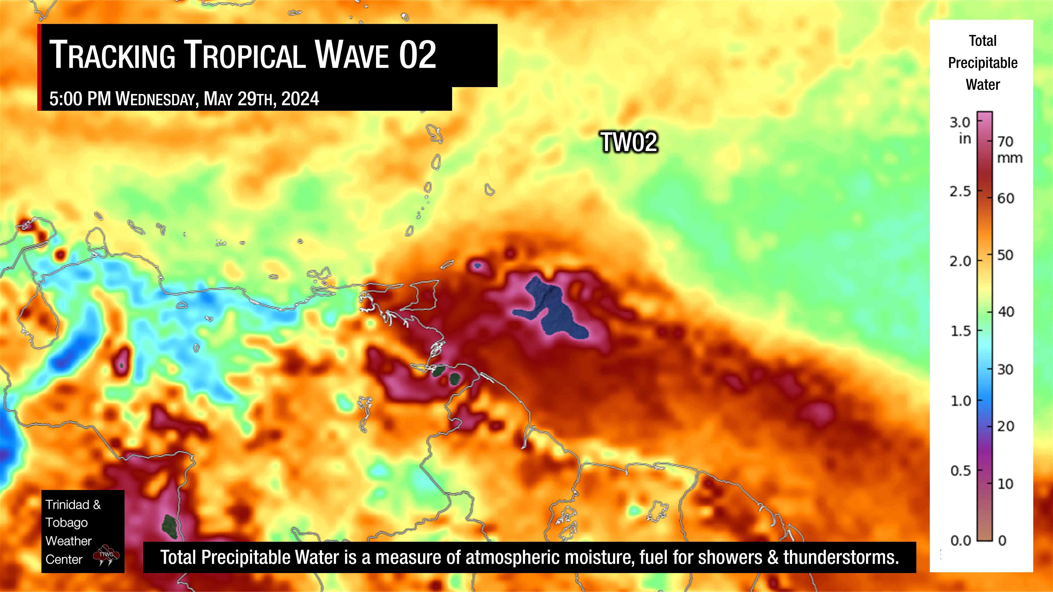
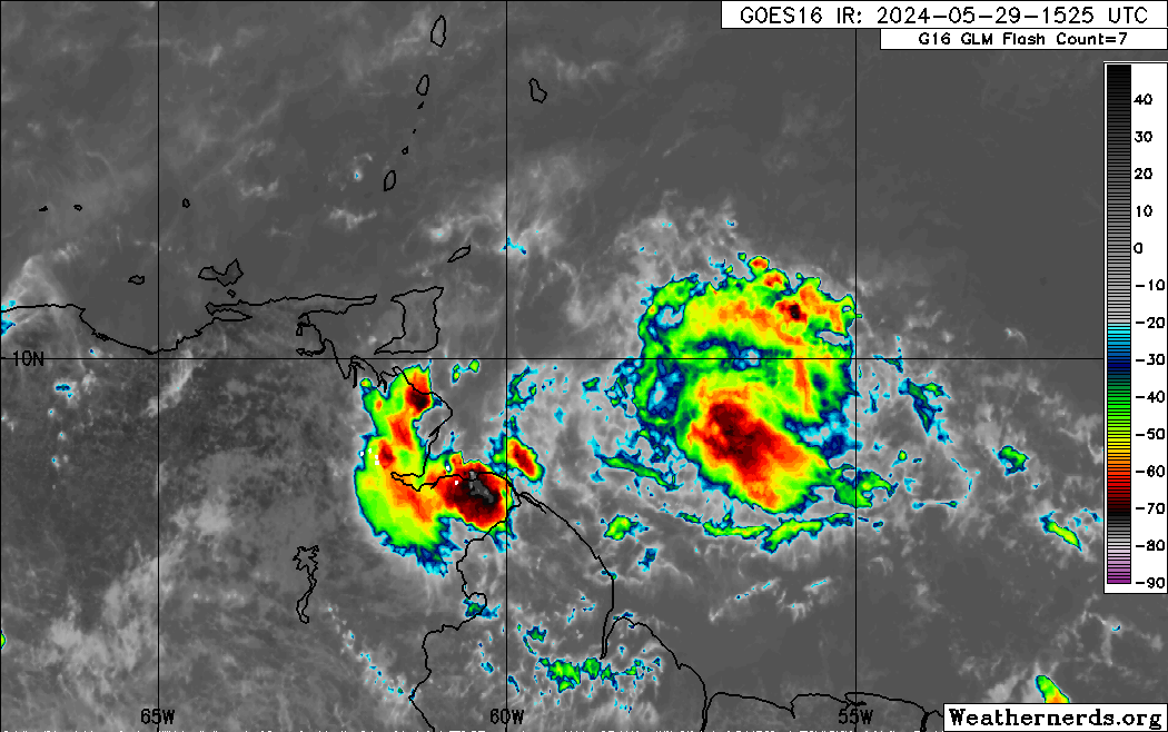
The second tropical wave analyzed by the National Hurricane Center is located just east of Trinidad and Tobago, with scattered showers and thunderstorms already moving across the country, producing locally heavy rainfall and gusty winds up to 56 KM/H (30 knots).
This wave is forecast to continue its westward path, producing locally heavy rainfall across Trinidad, Tobago, and the Windward Islands, mainly south of Martinique. Through Thursday night, up to 50 millimeters of rainfall is forecast, with higher rainfall accumulations favoring eastern areas of both islands and locally high totals across northern and southwestern Trinidad.
Across the wave axis, total precipitable water (TPW) values, which is a measure of atmospheric moisture, are high, between 2.5 and 3 inches. Wind shear is moderate to strong across the Lesser Antilles, with speeds up to 30 knots from west to northwest, which is forecast to keep heavier rainfall east and south of Trinidad and Tobago.
Tropical Wave 03
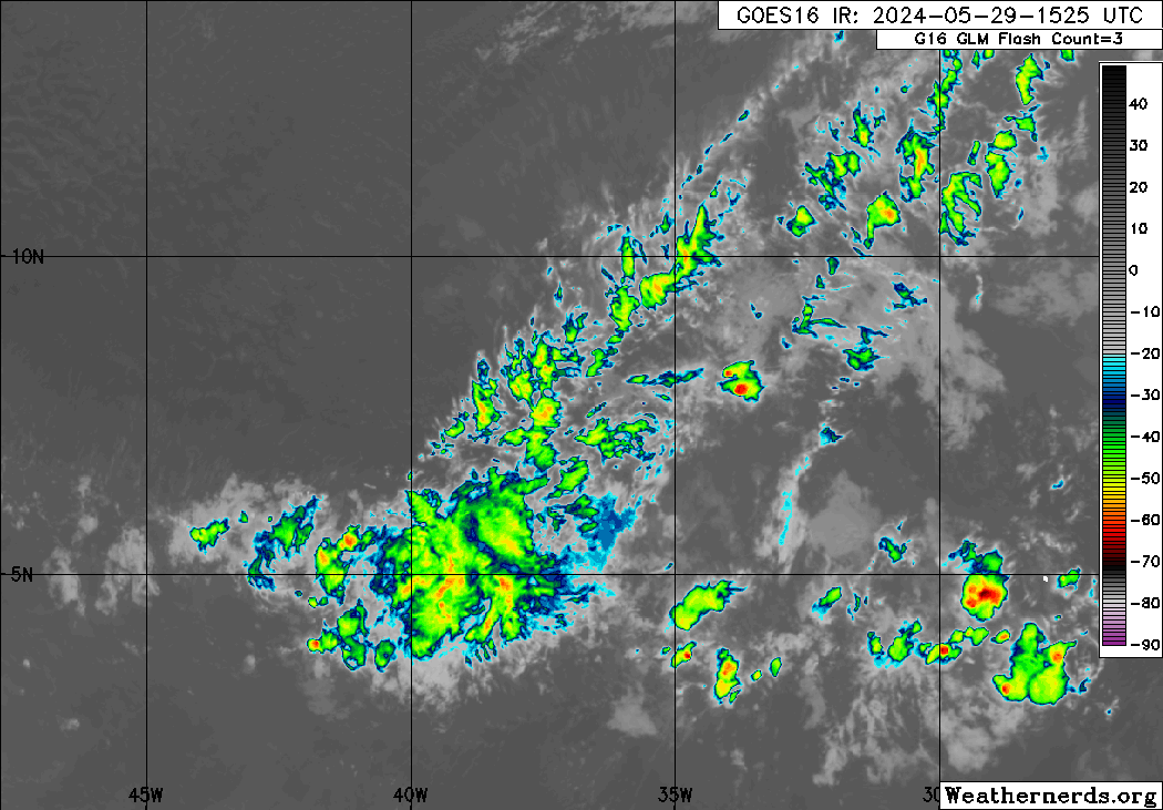
The third tropical wave analyzed by the National Hurricane Center remains in the central Main Development Region, midway between T&T and the West African coast. Over the last 48 hours, this tropical wave took advantage of the record-warm ocean temperatures, producing widespread cloudiness, showers, and thunderstorms. While convection pulsed with this wave as it moved across the Atlantic, it generally remained well-defined at the atmospheric levels where we look for a tropical wave signature. Based on its current trajectory, it is forecast to move across T&T on Sunday into Monday.
However, forecast models indicate that a developing low-pressure system in the far North Atlantic and a frontal system north of the Greater Antilles will influence the atmosphere across the Lesser Antilles, with strong to very strong northwesterly wind shear. As a result, while this wave’s signature may dissipate as it nears the Lesser Antilles but a deep plume of moisture will move across T&T, supporting cloudiness, sparse showers, and isolated thunderstorms on Sunday into Monday.
Tropical Wave 04
The fourth tropical wave analyzed by the National Hurricane Center moved off the African Coast over the last 24 hours and is forecast to move across the Atlantic Ocean over the next seven days, arriving across the Windward islands by next Wednesday. However, this is likely to be another weak wave.
Not Every Tropical Wave Brings Severe Weather
Tropical waves vary in intensity as they travel westward across the Atlantic. This variability can be on the order of days to as short term as hours. Sometimes, you may see satellite imagery that shows heavy thunderstorms and deep convective activity east of Trinidad and Tobago during the late night and early morning, but by daybreak – nothing.
This is due to diurnal (daily) variations in convective showers whereby convection peaks overnight and wanes during the day for already occurring convective systems (i.e., not triggered by daytime heating).
Activity can be enhanced by its proximity to upper-level troughs and the ITCZ but can also be degraded by hostile upper-level conditions and Saharan Dust.