


An area of low pressure in the east-central Subtropical Atlantic, well northeast of the Lesser Antilles, has captured the attention of the National Hurricane Center (NHC).
In a special Tropical Weather Outlook issued by the NHC at 4:10 PM Wednesday, April 24th, 2024, the NHC says, ” An area of low pressure located about 900 miles northwest of the Cabo Verde Islands has been producing a small but persistent area of showers and thunderstorms to the east of its center since this morning.”
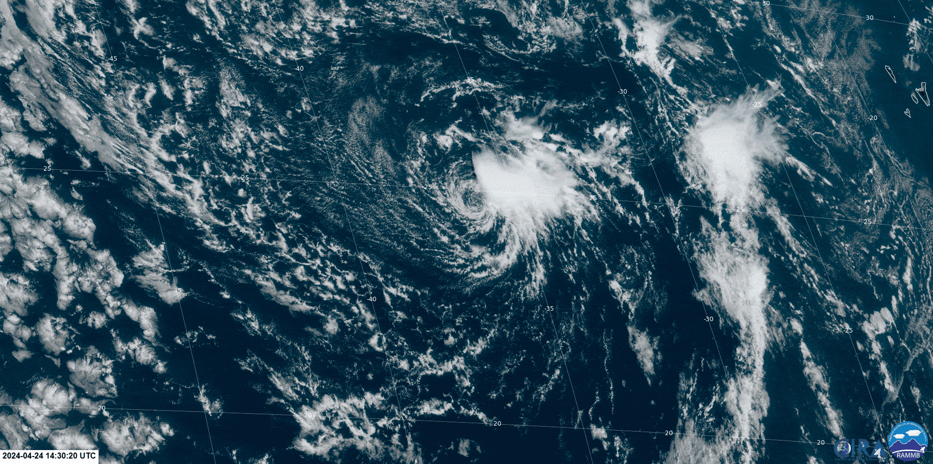
The NHC continued, “However, the low is forecast to move southwestward at 10 to 15 mph into an area of stronger upper-level winds tonight and tomorrow, and additional development is not expected.”
This low-pressure area has sea surface temperatures near 24°C, sufficient for subtropical development, but it is also in an area with very strong wind shear. Wind shear generally inhibits tropical development, and stronger wind shear is forecast across the low-pressure area on Thursday.

The National Hurricane Center has given this area a low (10%) chance of development over the next 48 hours and seven days, respectively. This system poses no threat to Trinidad, Tobago, and the remainder of the Lesser Antilles.
The official start of the 2024 Hurricane Season is June 1st, and there are no tropical waves east of T&T. The passage of a tropical wave or the movement of the Intertropical Convergence Zone across T&T will signal the start of the local Wet Season. The Trinidad and Tobago Meteorological Service says they expect the 2024 Wet Season to begin during the second half of May.
No additional Special Tropical Weather Outlooks are scheduled for this system unless conditions warrant from the NHC. Regularly scheduled Tropical Weather Outlooks will resume on May 15th, 2024, and Special Tropical Weather Outlooks will be issued as necessary during the remainder of the off-season.


