


Trinidad and Tobago is forecast to experience moderate seas over the next seven days winds remain fairly gentle to moderate.
There are no sea-based alerts, watches, or warnings from the Trinidad and Tobago Meteorological Service for Trinidad and Tobago at this time.
Seas Forecast For Trinidad and Tobago
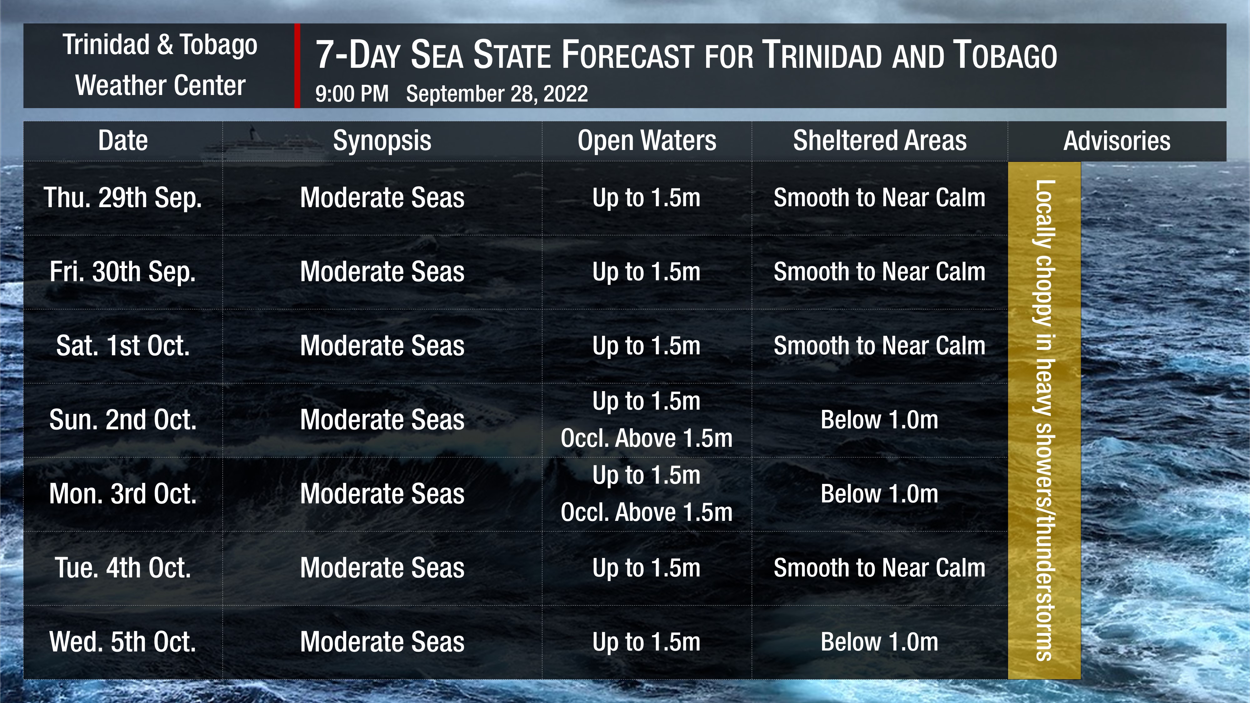
Seas are forecast to be moderate into next week. Waves in open waters are forecast to be generally between 1.25 and 1.5 meters into next week. In sheltered areas, waves are forecast to be below 1.0 meter becoming occasionally choppy in heavy showers or thunderstorms, particularly within the Gulf of Paria.
Swell periods are forecast to remain between 7 and 10 seconds coming from the northeast to east over the next seven days.
Winds are forecast to be gentle to moderate through next week with sustained winds between 5 to 15 knots from generally the southeast to the northeast, increasing by next Wednesday to up to 20 knots. Gusts during this period are forecast to reach 20 knots, accompanying isolated heavy showers or thunderstorms.
Saharan Dust is also forecast to increase by next Monday, with horizontal visibility and air quality marginally affected.


