


A low-level jet has developed across the Southern Windwards, producing strong winds at low levels of the atmosphere. In heavy showers and thunderstorms, these strong winds can make it to the surface, producing damaging gusty winds. Over the next 36 hours, a weakening tropical wave, the Intertropical Convergence Zone, and this low-level jet are all forecast to interact across T&T, producing isolated to scattered showers and isolated thunderstorms.
What you need to know
— Rainfall: Through the next 36 hours, isolated areas of rain, moderate to heavy showers, and isolated thunderstorms are forecast, interrupting variably cloudy skies. Peak intense activity, including isolated heavy to violent showers and intense thunderstorms, is forecast overnight tonight (Saturday) through Sunday afternoon, gradually settling by the evening. Rainfall totals between 10-25 millimeters are forecast across the country, with higher rainfall totals up to and exceeding 25 millimeters and up to 50 millimeters across localized areas of the eastern and southern halves of Trinidad and Tobago and along western coastal Trinidad.
— Hazards: The main hazards are gusty winds in excess of 45 KM/H (likely) to in excess of 55 KM/H (possible). Stronger gusts are forecast to accompany heavy showers or thunderstorms. Lightning will accompany thunderstorms. Chances for street/flash flooding are medium to high through Monday. Chances for riverine flooding remain low at this time.
— Alerts/Watches/Warnings: A High Wind Alert (Yellow Level) is in effect for Trinidad and Tobago from 8:00 PM Saturday, 30th July, 2022 through 8:00 PM Sunday, August 1st, 2022, from the Trinidad and Tobago Meteorological Service. There are no tropical storm or hurricane watches or warnings in effect for T&T at this time.
The High Wind Alert
The Trinidad and Tobago Meteorological Service has issued a High-Wind Alert (Yellow Level) on Saturday afternoon at 1:56 PM. The alert goes into effect at from 8:00 PM Saturday, 30th July, 2022 through 8:00 PM Sunday, August 1st, 2022.
Trinidad and Tobago is not under any tropical storm watch or warning at this time.
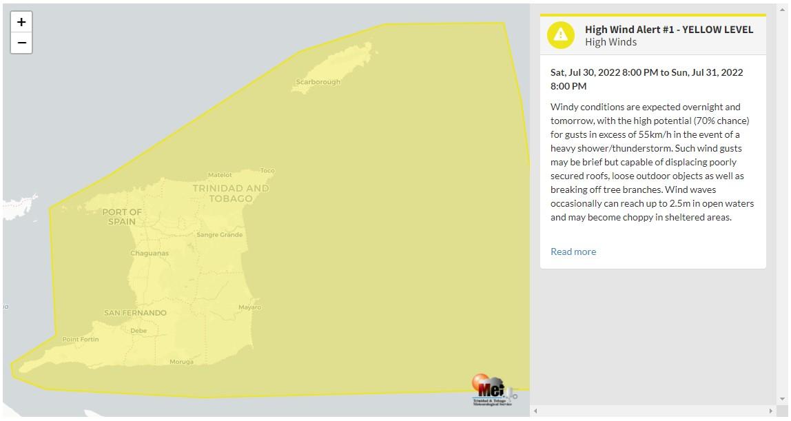
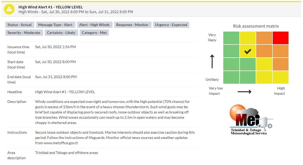
“Windy conditions are expected overnight and tomorrow, with the high potential (70% chance) for gusts in excess of 55km/h in the event of a heavy shower/thunderstorm. Such wind gusts may be brief but capable of displacing poorly secured roofs, loose outdoor objects as well as breaking off tree branches. Wind waves occasionally can reach up to 2.5m in open waters and may become choppy in sheltered areas.” according to the Trinidad and Tobago Meteorological Service. This “alert” status takes into account the possibility of the event occurring. This high wind event is likely.

The color of the alert indicates the severity of the event and the probability of the event occurring. Currently, the alert level is Yellow. This means that the hazard has been observed, but the severity of impacts is moderate for this particular alert. You should be aware of the hazards in your area associated mainly with gusty winds in excess of 55 KM/H.
For a moderate High Wind Alert, there is the potential for possible injuries, where behavioral changes are required to ensure safety. There may be minor damage to property, with income-earning temporarily disrupted, and a couple of communities are affected.
The Met Office is advising the public to secure loose items outdoors and livestock. Small craft operators should be on the alert for above-normal or choppy sea conditions in strong winds. Avoid venturing into floodwaters. The public should monitor weather conditions and updates from official sources.


