Trinidad and Tobago is forecast to experience near-normal seas over the next seven days as Spring Tides subside by Friday, with no strong low-level winds forecast across the region. However, Saharan Dust may reduce visibility.
There are no alerts, watches, or warnings from the Trinidad and Tobago Meteorological Service for Trinidad and Tobago at this time.
Seas Forecast For Trinidad and Tobago

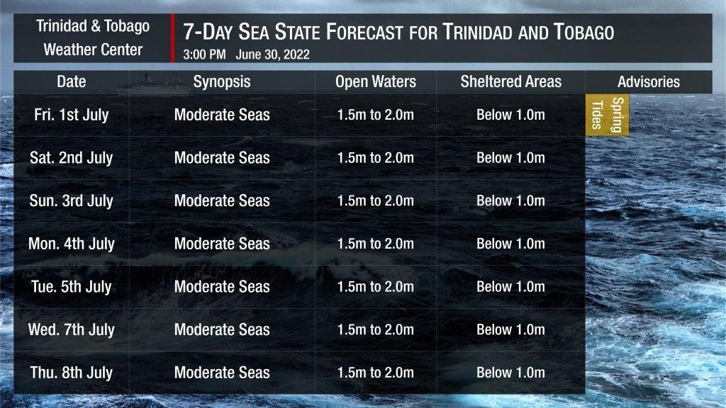
Seas are forecast to gradually return to normalcy with moderate seas. Waves in open waters are forecast to be between 1.5 and 2.0 meters. In sheltered areas, waves are forecast to be near or below 1.0 meters, becoming below 1.0 meter to near calm on Friday into Saturday as Tropical Wave 13/14 (a merged tropical wave) moves across the Lesser Antilles.
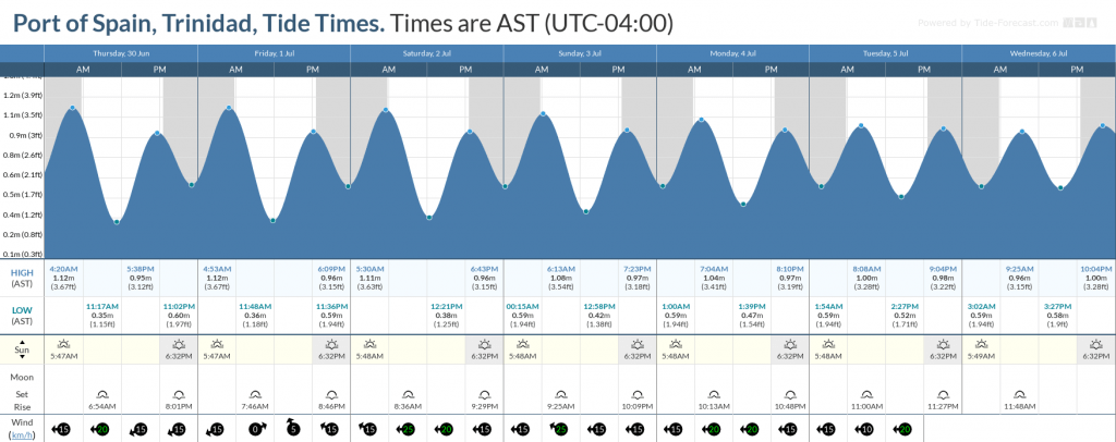
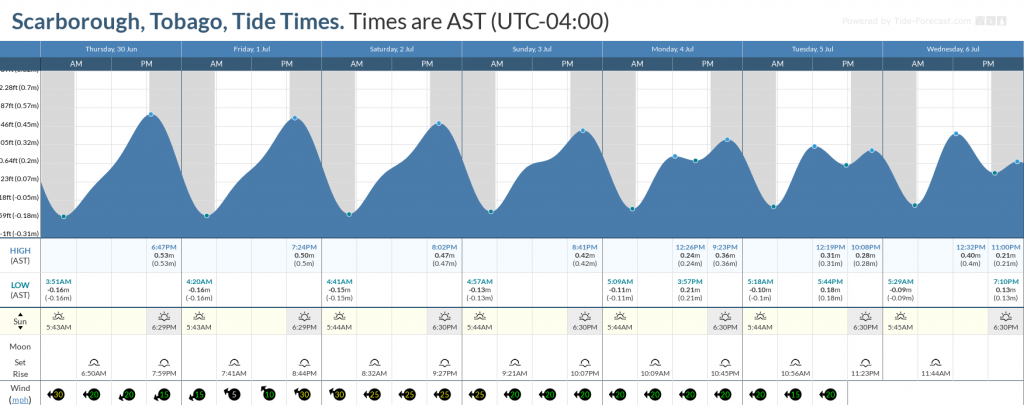
Spring tides will persist through Friday, July 1st, 2022. These are higher than usual high tides and lower than usual low tides which may exacerbate coastal flooding and lead to slower runoff from this week’s rainfall.
Saharan Dust is also set to return at moderate to high concentrations initially by late Saturday, with fluctuating concentrations through the upcoming week. Increased dust haze may reduce horizontal visibility to eight kilometers offshore.


