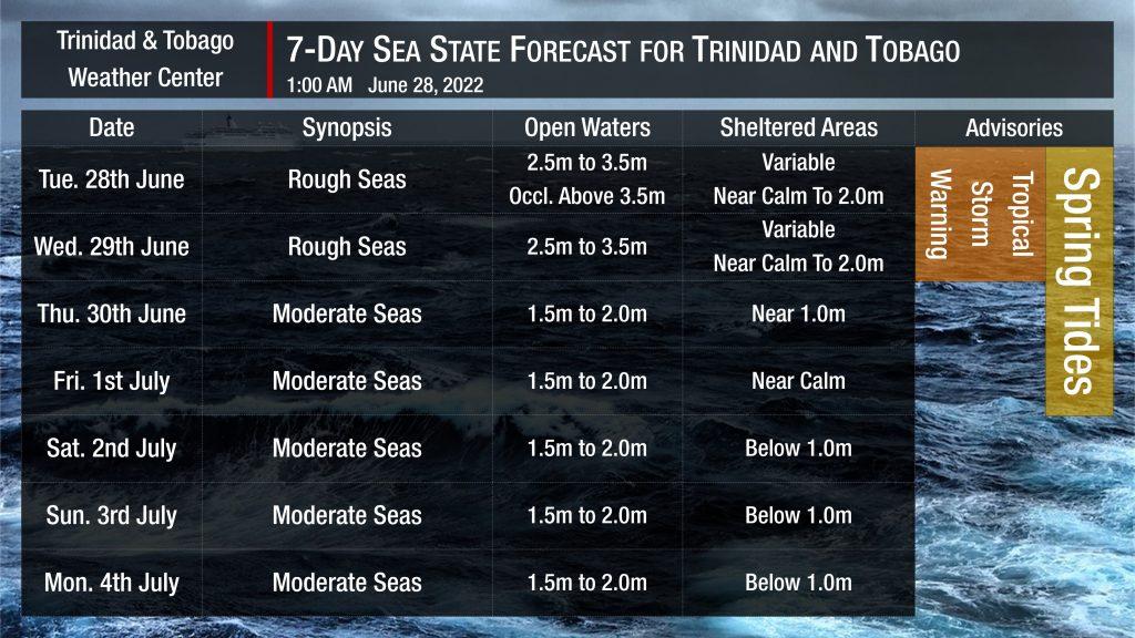
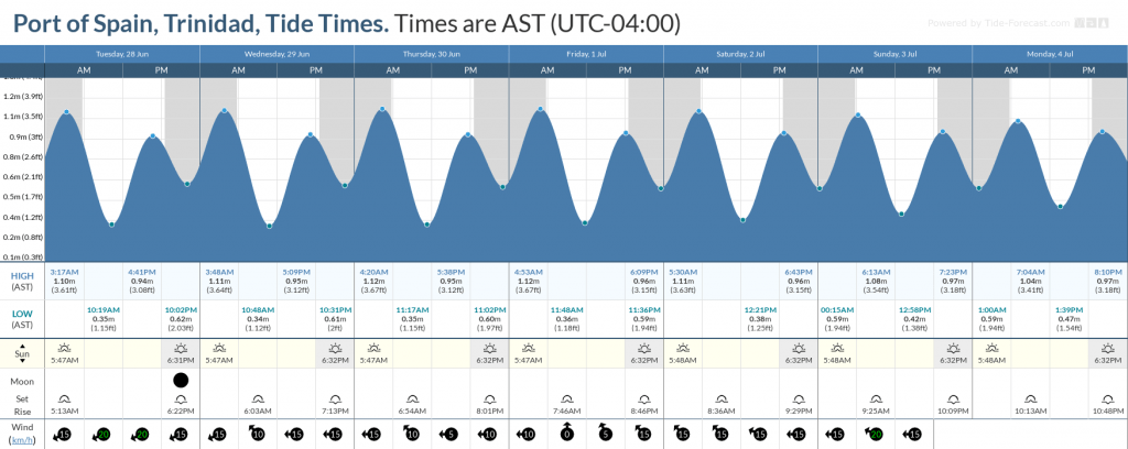
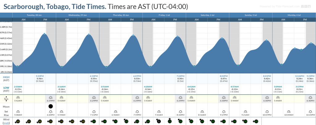
Trinidad and Tobago is forecast to experience hazardous seas through Wednesday due to a combination of wind-driven waves and storm surges associated with Potential Tropical Cyclone Two, as well as spring tides.
A Tropical Storm Warning (Orange Level) is in effect for Trinidad and Tobago until 5:00 PM Wednesday, June 29th, 2022 (or until discontinued) from the Trinidad and Tobago Meteorological Service.
Seas Forecast For Trinidad and Tobago

Through Wednesday, June 29th, 2022, seas in open waters are forecast to be rough, with waves between 2.5 meters and 3.5 meters, with higher open-water waves across the Atlantic-facing coasts of T&T. Along the same Atlantic-facing coasts of both islands, between one to three feet (0.3 – 0.9 meters) of storm surge is forecast. Storm surge, combined with higher than usual high tides, will lead to coastal flooding along low-lying coastlines of both islands.
Seas are forecast to be variable for sheltered areas of Trinidad and western Tobago, generally smooth through midday Tuesday, becoming agitated as PTC2 traverses the country. From mid-Tuesday, seas will be up to 1.5 meters in sheltered areas. For the southwestern Gulf of Paria, seas will be particularly agitated on Tuesday night, with waves occasionally above 1.5 meters. On Wednesday morning, hazardous seas shift to the northwestern Gulf of Paria. Between one to two feet (0.3 – 0.6 meters) of storm surge, combined with spring tides, will lead to coastal flooding along low-lying areas.
Mariners should secure boats and equipment away from nearshore areas.
By Thursday, seas are forecast to gradually return to normalcy with moderate seas. Waves in open waters are forecast to be between 1.5 and 2.0 meters. In sheltered areas, waves are forecast to be near or below 1.0 meters, becoming near calm on Friday as Tropical Wave 13 moves across the Lesser Antilles.
Spring tides will persist through Friday, July 1st, 2022. These are higher than usual high tides and lower than usual low tides which may exacerbate coastal flooding and lead to slower runoff from this week’s rainfall.


