


An active tropical wave is moving across Trinidad and Tobago with intervals of showers and isolated thunderstorms through early Tuesday. However, most of the intense activity is forecast to remain to the east of the country.
What you need to know
— Rainfall: Through the next 36 hours, periodic rain, moderate to heavy showers, and isolated thunderstorms are forecast. Through Tuesday afternoon, isolated heavy to violent showers and intense thunderstorms are possible favoring Tobago and eastern Trinidad. Rainfall totals between 15-35 millimeters are forecast across the country, with higher rainfall totals exceeding 35 millimeters across southern and eastern Trinidad and across Tobago. In highly isolated areas, rainfall totals through Tuesday could exceed 50 millimeters.
— Hazards: Chances for street/flash flooding are medium to high through Tuesday afternoon. Chances for riverine flooding remain low at this time. Gusty winds, in excess of 55 KM/H accompanying heavy showers or thunderstorms are likely. Lightning will accompany thunderstorms.
— Alerts/Watches/Warnings: An Adverse Weather Alert (Yellow Level) is in effect for Trinidad and Tobago from 5:00 PM Monday, June 20th, 2022 through 10:00 AM Tuesday, June 21st, 2022 from the Trinidad and Tobago Meteorological Service.
The Adverse Weather Alert
The Trinidad and Tobago Meteorological Service has issued an Adverse Weather Alert (Yellow Level) on Monday afternoon at 5:05 PM. The alert goes into effect at 5:00 PM Monday, June 20th, 2022 through 10:00 AM Tuesday, June 21st, 2022.
Trinidad and Tobago is not under any tropical storm watch or warning at this time.
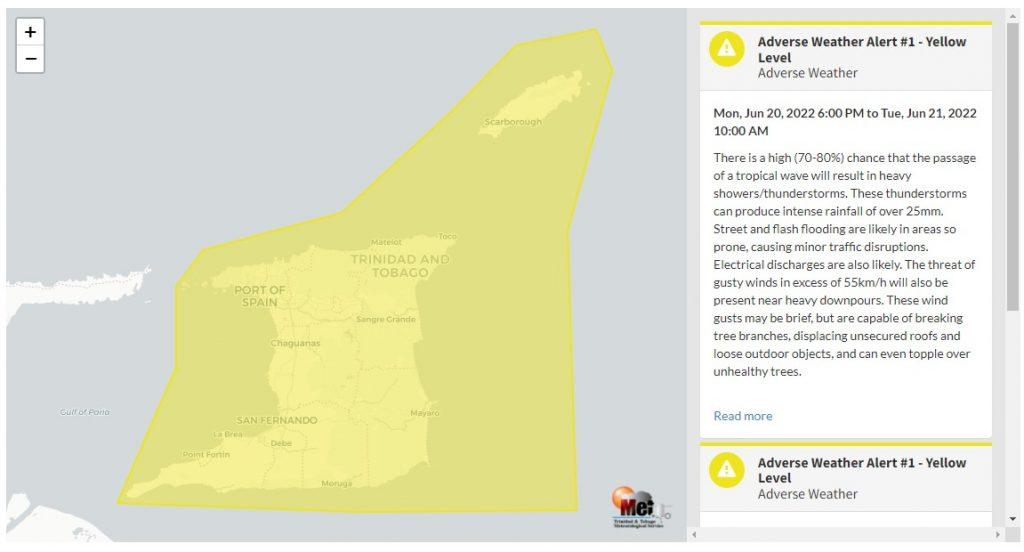
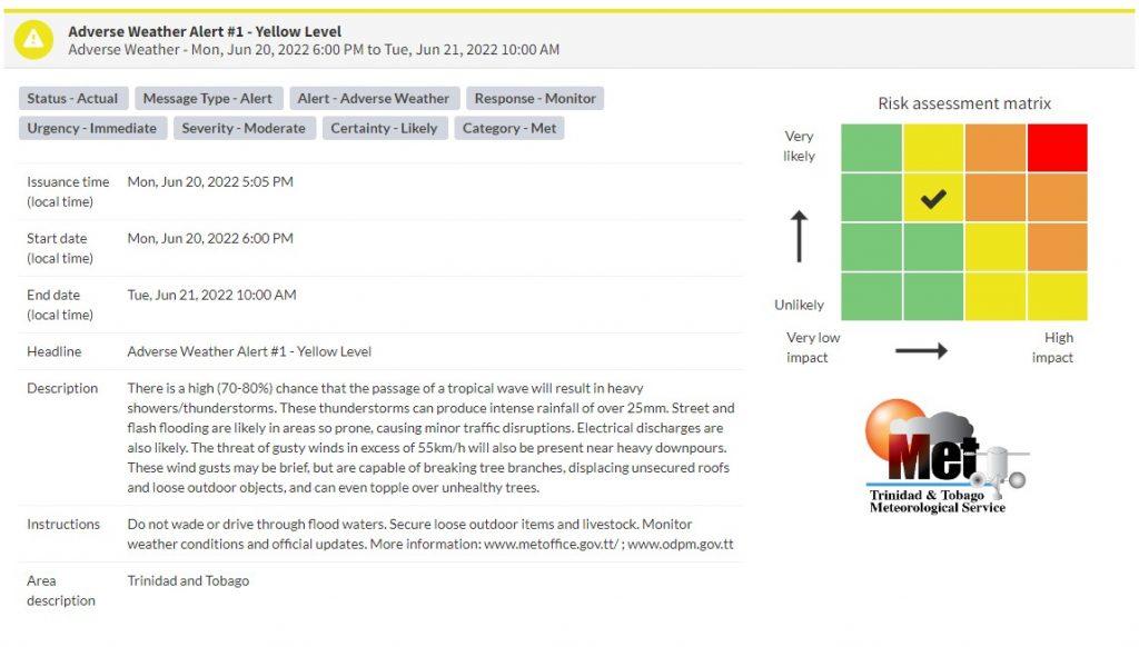
“There is a high (70-80%) chance that the passage of a tropical wave will result in heavy showers/thunderstorms. These thunderstorms can produce intense rainfall of over 25mm. Street and flash flooding is likely in areas so prone, causing minor traffic disruptions. Electrical discharges are also likely. The threat of gusty winds in excess of 55km/h will also be present near heavy downpours. These wind gusts may be brief, but are capable of breaking tree branches, displacing unsecured roofs and loose outdoor objects, and can even topple over unhealthy trees.” according to the Trinidad and Tobago Meteorological Service. This “alert” status takes into account the possibility of the event occurring. This adverse weather event is likely.

The color of the alert indicates the severity of the event and the probability of the event occurring. Currently, the alert level is Yellow. This means that the hazards are likely, but the severity of impacts is moderate for this particular alert. You should be aware of the hazards in your area associated mainly with gusty winds in excess of 55 KM/H, street, and flash flooding as well as frequent lightning.
For a moderate Adverse Weather Alert, there is the potential for possible injuries, where behavioral changes are required to ensure safety. There may be minor damage to property, with income-earning temporarily disrupted and a couple of communities affected.
The Met Office is advising the public to be alert for cloud-to-ground lightning activity and not venture into floodwaters, secure loose objects outdoors as well as monitor weather conditions and updates from official sources.
Small craft operators should be on the alert for above-normal or choppy sea conditions in strong winds.


