Seas Forecast: King Tides To Return From This Weekend

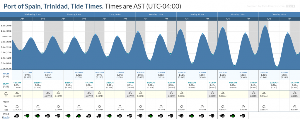
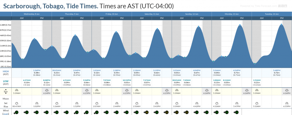
Some of the highest high tides and lowest low tides for 2022 are set to begin this weekend, ahead of the June 14th Supermoon. These tides are called King Tides, which usually indicate some of the highest tidal variations for a calendar year.

While these tides will affect nearshore areas, seas are forecast to remain moderate and occasionally choppy due to elevated low-level winds in open waters.

In addition, moderate to high concentrations of Saharan Dust will continue to reduce horizontal visibility offshore.

There are no marine alerts, watches, or warnings in effect from the Trinidad and Tobago Meteorological Service at this time.

Seas Forecast For Trinidad and Tobago

Sea state forecast through the next seven days, as moderate seas are forecast. Note that sheltered areas include bays, beaches, and generally the Gulf of Paria and western areas of the Columbus Channel in Trinidad and the western coasts of Tobago. Open waters are the Atlantic Ocean (Eastern Trinidad and Tobago), the Eastern Columbus Channel (Southern Trinidad), and the Caribbean Sea (north of Trinidad, west of Tobago).

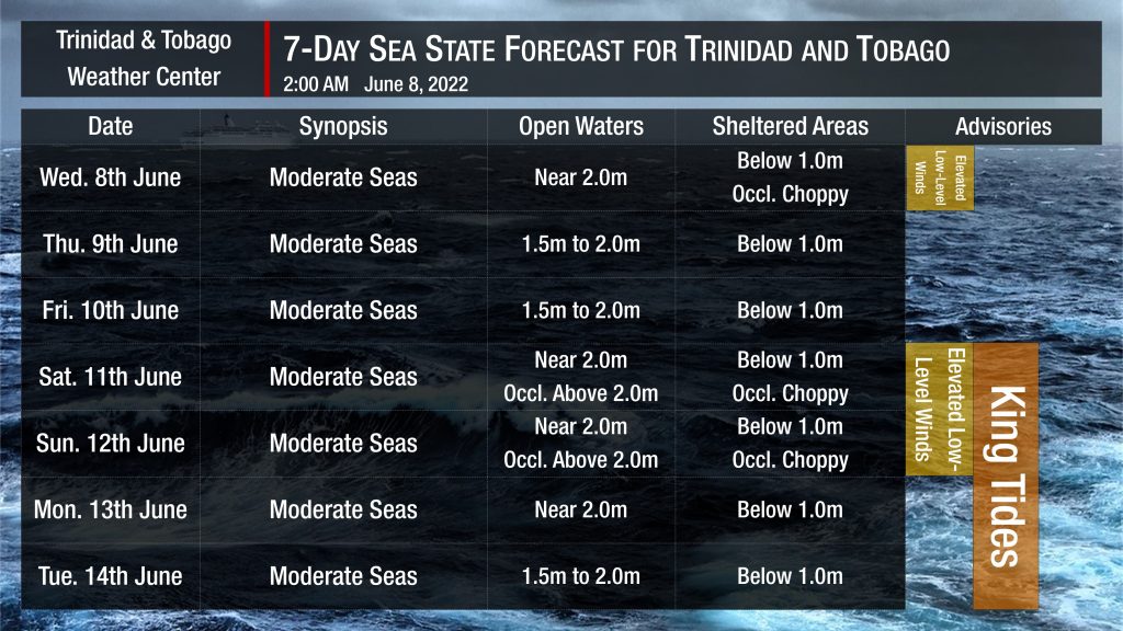
In sheltered areas, waves are forecast to be near or below 1.0 meters with occasionally choppy conditions due to elevated low-level winds and forecast heavy showers or thunderstorm activity through the weekend.

Winds are forecast to be moderate to fresh through the next several days, with sustained winds between 15 to 20 knots from the southeast to the northeast but gusts as high as 25 knots.

Generally, seas in open waters will remain moderate through the next seven days. In open waters, waves are forecast to generally be up to 2.0 meters through next week, occasionally becoming above 2.0 meters over the weekend.

Tidal forecast for Port of Spain, Trinidad (above) and Scarborough, Tobago (below) courtesy Tide-Forecast.com

Saharan Dust will continue affecting T&T even with anticipated rainfall. Dust haze will gradually diminish into the weekend, with another surge set to arrive by Sunday, June 12th, 2022. Horizontal visibility may dip as low as 6 kilometers outside of shower or thunderstorm activity.

Total
0
Shares
Related Posts
Total
0
Share
perihoki perihoki perihoki perihoki perihoki duta76 duta76 duta76 duta76 duta76 duta76 melesat bareng kakek zeus gates of olympus duta76 sweet bonanza scatter beruntun pemain duta76 auto wd strategi rahasia jackpot rtp pgsoft mahjong ways 2 maxwin bukan lagi mimpi di sugar rush 1000 duta76 pemain duta76 berhasil jepe mahjong ways 2 berkat pola ini pola jitu mahjong wins 3 panen cuan besar duta76 petir gates of olmpus zeus turun sesuai jadwal perihoki mahjong ways 2 pgsoft perihoki beri trik dan tips pro player heboh pemain perihoki mahjong wins 3 dapat scatter hitam Bocor pola dewa naga mahjong ways Pola dewa guntur mahjong ways 2 komunitas bomber Pola turbo fibonacci mahjong ways2 modal rp20ribu Strategi turbo spin mahjong wins 3 cirebon Wild scatter fibonacci mahjong wins 3 pemain malam ragu jadi percaya ari jackpot rtp prediksi naga mahjong ways rtp scatter hitam mahjong wins 3 kunci super win scatter merah penawaran scatter hitam mahjong ways 2